Discover Blake Falls Reservoir

A paddle past the Blake O’Neil campground
TRAIL ACTIVITY
LENGTH
3.10 miles, One Direction
DIFFICULTY
Easy, Moderate
TOWN
Parishville
SURFACE
Lake/Pond
PETS
Permitted
FEES
No

Description

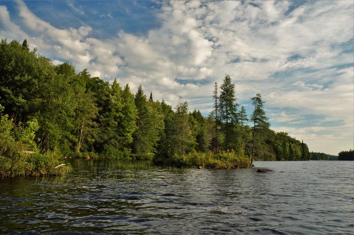
Blake falls reservoir is 631 acres and has nearly 18 miles of shoreline. The reservoir is primarily long and narrow, running south to north. This tends to offer calmer waters during windy days as compared to Carry & Stark reservoirs. There is a large bay system to the east of the main channel that has very calm waters and is nice to explore. This section offers good chances of spotting wildlife.

The Blake McNeil campground is located on the left as you paddle downstream. There have been instances where personal watercraft have caused some unpleasant paddling experiences. This is the exception, not the rule- but keep yourself conspicuous and out of the way when you are on waters shared with motorized watercraft. The carry is on the left as you near the caution buoys.

Nearby hiking trails include the system at Higley Flow State Park and Clear Pond. ATV's can also access the County's extensive trail network through the St. Lawrence County Multi-Use Trailhead in South Colton. 

Trail Manager

For more information, contact:

Brookfield Renewable

Brookfield Renewable
200 Liberty Street, 14th Floor
New York, NY 10281
Newyork@brookfieldrenewable.com
View website

Nearby Businesses

Trail Tips

Slippery when Wet
Some trails will be slippery after a rain or if they are covered in fallen leaves. Watch your step!
Legend
Hide All

Trailhead Information

South- hand-carry launch: From NY-56, turn onto Stark Rd and continue for 2 miles. The launch is on the left side of the road, across from the road to the Stark Falls Reservoir launch. The carry is 0.7-miles along an old woods road. A two-wheeled cart is usable on this carry.

North- hand-carry launch: From NY-56, turn onto to Stark Rd and continue for 0.9 miles. Turn left onto Raquette River Road and continue 3.3 miles and turn right onto the Blake Falls Dam Road. Continue 1.5 miles and the parking area is next to the dam. The carry goes around the red gate and reaches the launch in 0.1-miles.

West- Boat launch: From NY-56, turn onto Stark Rd and continue for 0.9 miles. Turn left onto Raquette River Road and continue 3.3 miles and turn right onto the Blake Falls Dam Road. Continue 1.5 miles and the launch will be on the right.

Click on a parking icon to get custom directions
Please Sign In or Create Account to add comments.
Safety
Be a Safe and Respectful Paddler
Paddling conditions will vary according to the weather and season, so always exercise caution and always wear a lifejacket; be prepared to swim and never boat alone. File a float plan with a friend who will check up on you. With good judgment and proper equipment, the risk associated with paddling can be minimized. Respect the natural world and the rights of landowners, and be considerate of other outdoor enthusiasts. Paddlers should seek to avoid causing erosion, trampling vegetation, disturbing wildlife, and harming water quality.
SHARE THIS TRAIL

Add Trail Log

Please wait…
Join In on the Fun!
Log in or create an account below to unlock all the great features of STLC Trails: keep track of trails you want to do, preserve memories of trails you’ve done, earn badges, and more!
Your log in attempt was not successful. Please try again.
    Lost your password? Reset your password
    Don't yet have an account?
    There was an issue with your submission. Please try again.
      * Indicates required field
      Already have an account? Login here
      Enter your username, and we will send you a new, randomly generated password to your email account.
      There was an issue with your submission. Please try again.

        Success! A new password has been emailed to you.

        Log in now

        Please wait…